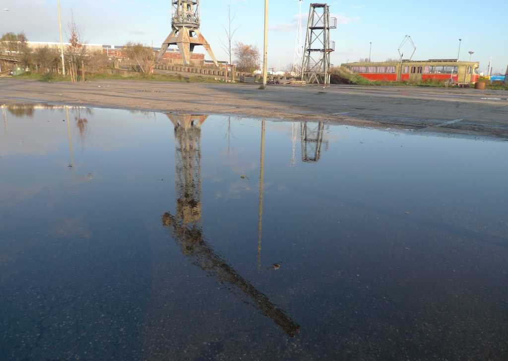
1. The NDSM Warehouse
NDSM (Dutch Dock and Shipbuilding Company) covered about two square kilometers of the IJ-shores. Colossal hangars, towering cranes and long slopes, where enormous ships were let into the water. This is where Shell had its tankers built, and the Royal Marines were also regular customers. By the end of the nineties, after years of vacancy, artists and creatives started to discover the NDSM wharfs. They saw possibilities to settle there, after many of them had been evicted from cultural buildings in the center.
2. Noorderlicht
On the IJ shore you'll find a hangar-like greenhouse. It’s cafe and restaurant Noorderlicht, where cups of tea, beers and cocktails are served. At night you'll often find people dancing.
3. IJ-kantine
The IJ-kantine used to be the canteen for dockworkers. Canteen is a bit of an understatement for the grand cafe stature of this brasserie.
4. Container homes
Behind the IJ-kantine there’s another type of building generally associated with ports. To overcome the housing shortage among students, an unconventional solution was found: housing the students in shipping containers.
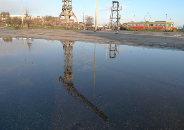
If you follow the road that runs behind the container homes, you'll end up at Kraanspoor.
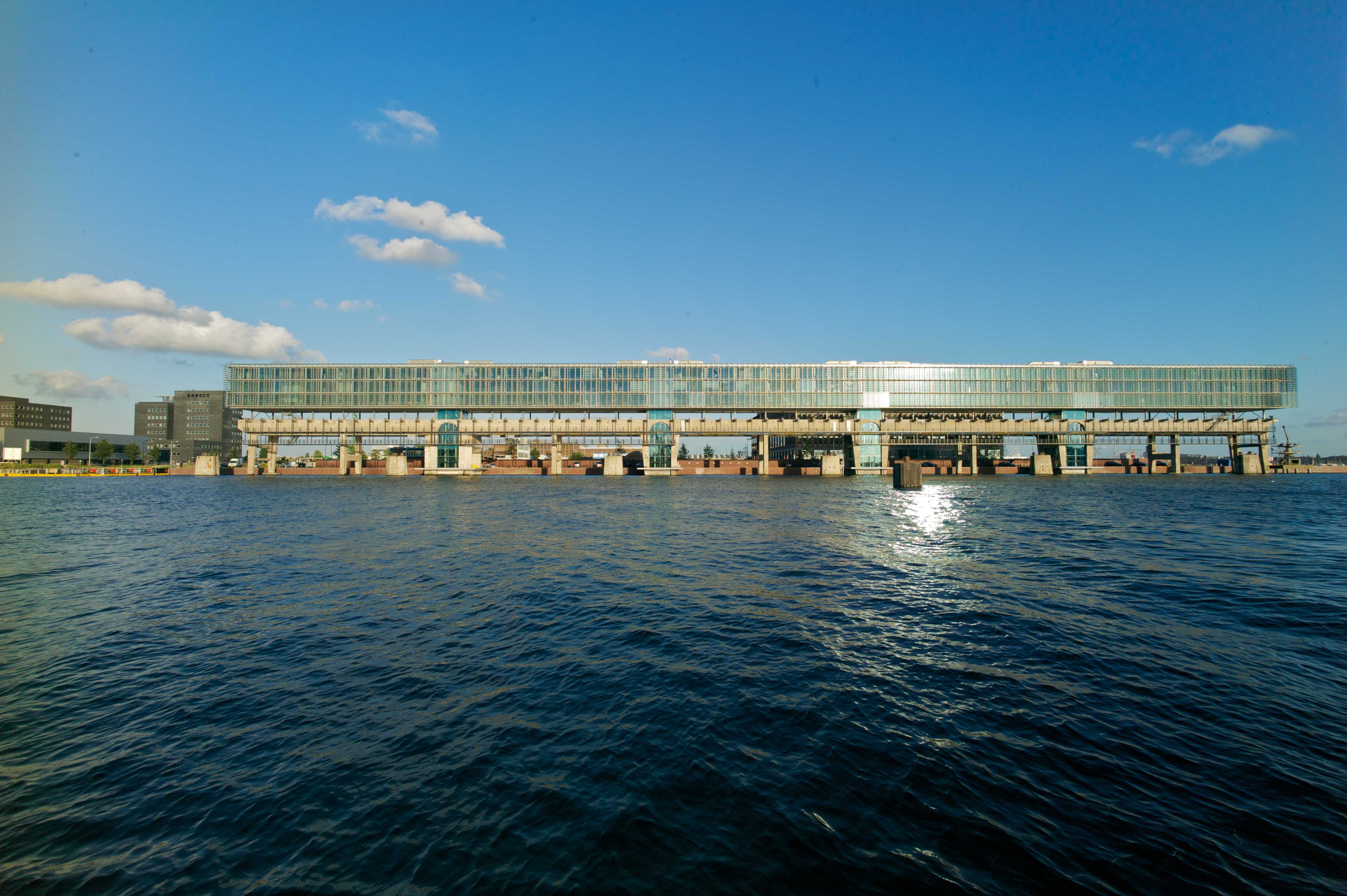
Kraanspoor (and studenthousing) - May 19, 2008 - Picture by Edwin van Eis.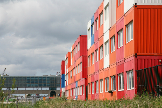
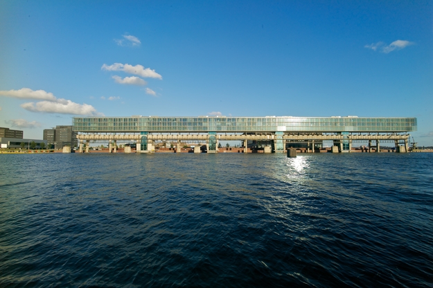
5. Kraanspoor
In 1997, architect Trude Hooykaas cycled past the NDSM-wharf to find a new space for her company. She found this concrete colossus that used to be a playground for giant cranes. 270 meters long and more than 13 meters high, this concrete caterpillar on tall legs was just longing to be used again. Ten years later the construction finally became the socle for Hooykaas’ design: a long, light glass volume that almost seems to float above this bit of industrial heritage.
Take the street parallel to Kraanspoor and leave the IJ behind you. Take the first road to the right after Kraanspoor and then turn left. Cross the big road and turn left again, following the road all the way into Tuindorp Oostzaan.
6. Tuindorp Oostzaan
Behind the NDSM-wharf lies Tuindorp Oostzaan, where in the old days the lion’s share of the dockworkers lived. Many people in Tuindorp Oostzaan belonged to a club. In 1930 a clubhouse was built: Zonnehuis. Zonnehuis has a cozy lunchroom and a theater hall.
If you exit Tuindorp Oostzaan on the north side, you'll find yourself on a dike. Turn right.
7. Kadoelen
Just like Nieuwendam, Kadoelen is a Dutch dike village. However, living in Kadoelen was nowhere near as nice. The word ‘kadoelen’, a name also found in other Dutch area’s, means ‘tough place to live in’ (‘Quaad Dolen’). Kadoelen is a forgotten corner above the IJ, where simple ranchers with marginal existences were living on swampy grounds. The place was infested with mosquitoes, spreading malaria in Amsterdam until 1950.
Continue on the dike in the same direction. You are now cycling over Landsmeerderdijk past the farmlands. As the road winds away from the water, you take the first street on your right, the second left, and the first right again. The road you then cross is Papaverweg.
8. Papaverweg
In the old hangars on Papaverweg you'll find Neef Louis, where they sell fantastic second hand furniture and paraphernalia. On the opposite side of the road lies a field, a small slice of wild nature where pheasants and foxes are said to be roaming, and stories circulate about people living in the bushes. Continue over the bridge, turn left, then right, and take the first left again.
9. Asterdorp
The only landmark left signaling what used to be here, is the gate building. In the old days, this was the only entrance to Astendorp, a so-called ‘living school’ where rowdy families and asocial people were re-educated. There was a high wall around the little ‘village’, that resembled more of a prison: the gate closed at 10 pm. During World War II, Jewish Amsterdammers were locked in here before they were deported to camp Westerbork. In 1955, Astendorp was demolished.
Bike all the way to the end of the road and take a left. You are now on Distelweg. Follow the road as it veers to the left. After passing the Shell building, turn left again.
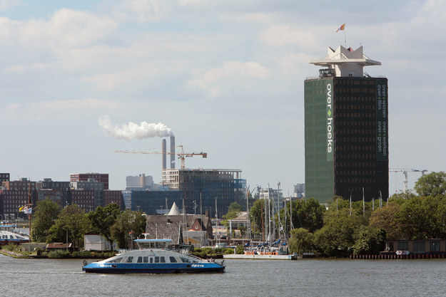
10. Overhoeks
Overhoeks was originally the Shell tower’s name, but now the entire development area bears the same name. You can already see apartment buildings rising, and the foundations for office buildings, one and a half times the size of the Shell tower itself, are being laid. In 1917, this spot was where the emergency village Obelt lay, and where the first Amsterdammers moved into temporary wooden accommodations. Because of their terrible quality, the wooden houses were called ‘the orange crates of Wibaut’.
If you bike further towards the IJ, you'll end up at our starting point: the ferry. Have a bite to eat at Ponthuys, or a bit further at Tolhuistuin.